Log in
All resources
Create a design
516 Free Images of 1860 Maps
gemeente atlas van nederland - south holland
1860s maps of south holland
19th-century maps of rotterdam
pages with maps
cc-zero
gemeente atlas van nederland - north holland
1860s maps of north holland
architecture
netherlands in the 1860s
rotterdam in the 1860s
prussia
lawn
building structure
roof
architecture
city
self-published work
architecture
architecture
village
self-published work
architecture
architecture
exterior
self-published work
architecture
1860s maps of palestine
al-salihiyya
self-published work
lawn
media from the national library of finland
classicism
istván széchenyi
thonet furniture
self-published work
pages with maps
self-published work
architecture
1895 maps of new york (state)
old maps of albany, new york
maps in the library of congress
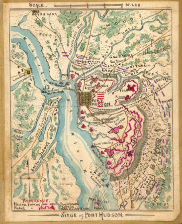
fortifications of port hudson
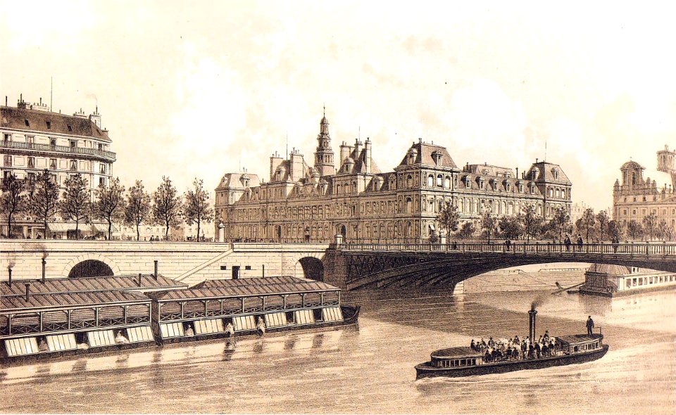
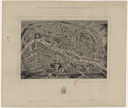
vue (en relief et à vol d'oiseau) de paris by jacques-alphonse testard
maps of paris from bibliothèque nationale de france
gemeente atlas van nederland - south holland
maps of peursum
gemeente atlas van nederland - south holland
maps of zoeterwoude
gemeente atlas van nederland - north holland
19th-century maps of amsterdam
gemeente atlas van nederland - south holland
1860s maps of south holland
media from the national library of finland
classicism
maps in the rijksmuseum amsterdam
published by frans buffa & zonen
gemeente atlas van nederland - south holland
19th-century maps of rotterdam
gemeente atlas van nederland - south holland
19th-century maps of rotterdam
gemeente atlas van nederland - south holland
1860s maps of south holland
maps in the rijksmuseum amsterdam
published by frans buffa & zonen
19th-century maps of south holland
maps of veur
gemeente atlas van nederland - north holland
maps of haarlemmermeer
19th-century maps of russia
russia in the 1860s
gemeente atlas van nederland - north holland
amsterdam in the 1860s
gemeente atlas van nederland - north holland
19th-century maps of amsterdam
maps in the rijksmuseum amsterdam
published by frans buffa & zonen
gemeente atlas van nederland - south holland
maps of noordeloos
gemeente atlas van nederland - north holland
maps of aalsmeer
gemeente atlas van nederland - south holland
19th-century maps of rotterdam
old maps of england
1860 maps
maps from the mechanical curator collection available to georeference
maps from the mechanical curator collection
admiralty charts 2601-2800
sligo bay
gemeente atlas van nederland - south holland
19th-century maps of rotterdam
cornell's primary geography (1860)
1867 maps of canada
19th-century maps of russia
russia in the 1860s
gemeente atlas van nederland - south holland
1860s maps of south holland
maps of nieuwpoort, south-holland
vestingwerken nieuwpoort
media from the national library of finland
classicism
gemeente atlas van nederland - south holland
old maps of the hague
gemeente atlas van nederland - south holland
1860s maps of south holland
gemeente atlas van nederland - south holland
19th-century maps of rotterdam
gemeente atlas van nederland - south holland
maps of zuidland
admiralty charts 2601-2800
tralee
gemeente atlas van nederland - south holland
19th-century maps of rotterdam
gemeente atlas van nederland - south holland
1860s maps of south holland
maps in the rijksmuseum amsterdam
published by frans buffa & zonen
maps in the rijksmuseum amsterdam
published by frans buffa & zonen
kaart van suriname naar opmetingen gedaan in de jaren 1860-1879
albina, suriname
1860s maps of new york (state)
maps showing 1776
gemeente atlas van nederland - south holland
old maps of katwijk, south holland
gemeente atlas van nederland - south holland
maps of groot-ammers
gemeente atlas van nederland - south holland
1860s maps of south holland
gemeente atlas van nederland - south holland
maps of wateringen
gemeente atlas van nederland - south holland
1860s maps of south holland
crystal palace in sydenham
1860s maps of london
history of yokohama
maps of yokohama
19th-century maps of the ottoman empire
maps in the british museum
gemeente atlas van nederland - south holland
maps of alblasserdam
gemeente atlas van nederland - south holland
old maps of brielle
gemeente atlas van nederland - south holland
maps of hellevoetsluis
gemeente atlas van nederland - south holland
1860s maps of south holland
gemeente atlas van nederland - south holland
maps of 's-gravenzande
gemeente atlas van nederland - south holland
old maps of dordrecht
gemeente atlas van nederland - south holland
old maps of gorinchem
gemeente atlas van nederland - south holland
maps of maassluis
gemeente atlas van nederland - south holland
19th-century maps of rotterdam
gemeente atlas van nederland - south holland
19th-century maps of rotterdam
gemeente atlas van nederland - north holland
maps of diemen
gemeente atlas van nederland - south holland
19th-century maps of rotterdam
gemeente atlas van nederland - south holland
1860s maps of south holland
gemeente atlas van nederland - south holland
1860s maps of south holland
gemeente atlas van nederland - south holland
1860s maps of south holland
gemeente atlas van nederland - south holland
1860s maps of south holland
1860 valentine map of new york city
george hayward
gemeente atlas van nederland - south holland
maps of heenvliet
gemeente atlas van nederland - gelderland
netherlands in the 1860s
gemeente atlas van nederland - north holland
old maps of beverwijk
gemeente atlas van nederland - south holland
1860s maps of south holland
gemeente atlas van nederland - south holland
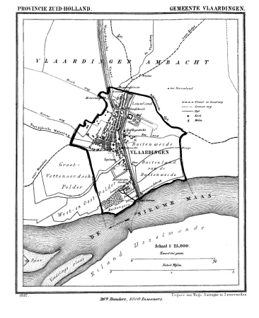
old maps of vlaardingen
gemeente atlas van nederland - south holland
1860s maps of south holland
gemeente atlas van nederland - south holland
1860s maps of south holland
gemeente atlas van nederland - south holland
1860s maps of south holland
gemeente atlas van nederland - south holland
1860s maps of south holland
dutch baroque architecture
old maps of amsterdam
gemeente atlas van nederland - south holland
1860s maps of south holland
chicago and the midwest, newberry library
cartographic reliefs
gemeente atlas van nederland - north holland
old maps of haarlem
gemeente atlas van nederland - north holland
19th-century maps of den helder
gemeente atlas van nederland - south holland
1860s maps of south holland
gemeente atlas van nederland - south holland
1860s maps of south holland
1860 valentine map of new york city
george hayward
gemeente atlas van nederland - south holland
1860s maps of south holland
portrait paintings by michele gordigiani
scapigliatura
101 - 200 of 516
Next page
/ 6